It's growng. Slowly.
My knowledge of Footscray soccer history has grown from zero to really not very much in a year. But 'not very much' is perhaps about as much as anyone else knows. The people who should know: Footscray historians and soccer historians have left it in either the "well I'll be buggered, who'da thunk" box or the "too hard basket". John Lack's history of Footscray, for example, fails to mention the game at all, and the Footscray Historical Society (FHS) had little idea until very recently. To be fair they have welcomed me with open arms and have been particularly supportive, supplying a number of vital leads explored below.
Yet for nearly a 20 year period, bewteen 1914 and the mid 1930s, Footscray, in the form of Northumberland & Durhams and Footscray Thistle, can be fairly described as a driving force of Victorian soccer, one or the other being there at the business end of most senior competitions. The lack of knowledge about the two clubs is not surprising but it remains an annoyance.
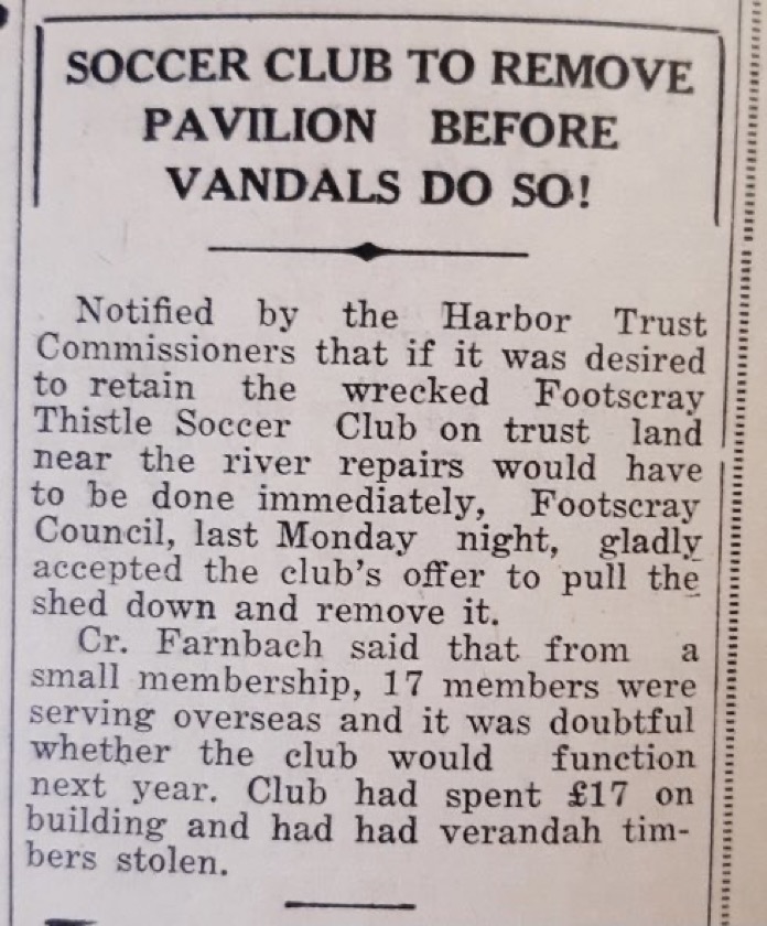 |
| Footscray Advertiser July 1940 |

On Saturday morning 29 May I undertook to try to find and video clues as to the ground's location, producing this 6 minute mini doco on twitter, typically inspiring #sokkahtwitter to chip in. While the general consensus seemed to be that the Southern side was most likely, we could not be sure. Discovering the below aerial shot looking west seems to have solved the puzzle. It places the ground squarely on the south side. The large road in the right foreground which crosses the river is Napier St and the patch of ground to its left seems the only possible space for a soccer ground.
 |
c1939 Footscray looking West, ID: 1528, |
 |
| A crop of the above image at the corner of Napier and Moreland Strees. |
Well, that's 1939-40 knocked over. The harder job is to work backwards and map them all. We know from documents provided by Val Nicholson, that in 1935-36 the club definitely played out of Yarraville Cricket Club's ground on Williamstown Road. It is likely they also played there all the years from 1932 until 1938. Earlier they played at Yarraville Gardens, and sometimes on Ammunition Flat and a number of other grounds the names of which are rendered unclear in newspaper reports.
I'm confident we can get there and map the places Footscray Thistle (and Northumberland & Durhams) called home.
No comments:
Post a Comment